
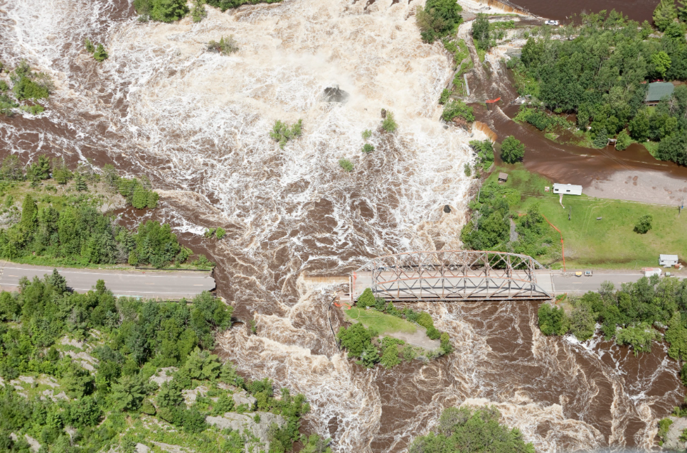
Effective flood risk assessment plays a crucial role in disaster management, and hydrologic modelling allows us to mitigate potential impacts. For those unaware, hydrologic modelling uses computer models to simulate and predict the behaviour of water bodies. They take precipitation, evaporation and transpiration, infiltration, and runoff into account.
This provides insights into the complex dynamics of water flow and distribution.
Role in Flood Risk Assessment
- Identifying flood-prone areas: By analyzing topography, hydraulic networks, land use, and hydrological data, models can identify areas at high risk of flooding. This knowledge helps policymakers and planners make informed decisions to reduce vulnerability.
- Estimating flood magnitude and frequency: Hydrologic models enable us to estimate the likelihood and severity of floods based on historical data and current conditions. This information is crucial for designing appropriate infrastructure and emergency response plans.
- Analyzing the impacts of land-use changes and climate change: Hydrologic models can simulate the effects of land-use alterations and climate change scenarios on flood risk. This knowledge allows us to evaluate the potential consequences and adapt our strategies accordingly.
Types of Hydrologic Models
- Empirical models: These models establish simple relationships based on historical data and observations. While less accurate, they are useful when detailed data is scarce.
- Conceptual models: These models represent hydrological processes using mathematical equations, providing a higher level of detail and accuracy.
- Physically-based models: These models offer the most detailed simulations, considering the physics of water movement and interactions. They are especially useful for complex environments but require substantial data and computational resources.
Key Steps in Hydrologic Modelling
- Data collection: Gathering meteorological, topographical, and land-use data is essential for building accurate models.
- Model selection and calibration: Choosing the appropriate model and adjusting its parameters to match observed data is crucial for reliable predictions.
- Scenario analysis: Simulating various flood events under different conditions helps evaluate the potential impacts and inform decision-making.
- Uncertainty analysis: Recognizing the limitations and uncertainties inherent in the models’ predictions allows for a more nuanced understanding of flood risk.
Real-World Applications
- Urban planning and development: Models guide decisions on land use, ensuring flood-prone areas are appropriately managed to minimize risk.
- Infrastructure design: Models assist in sizing stormwater systems and designing flood control structures to protect communities from potential flood damage.
- Emergency preparedness: Hydrologic models aid in developing evacuation plans and effectively allocating resources during flood events.
Conclusion
Hydrologic modelling, with its ability to predict flood behaviour and identify vulnerable areas, helps communities make informed decisions. This leads to reduced impacts of devastating floods. Understanding the value of hydrologic modelling encourages proactive measures in building resilient communities.